Title
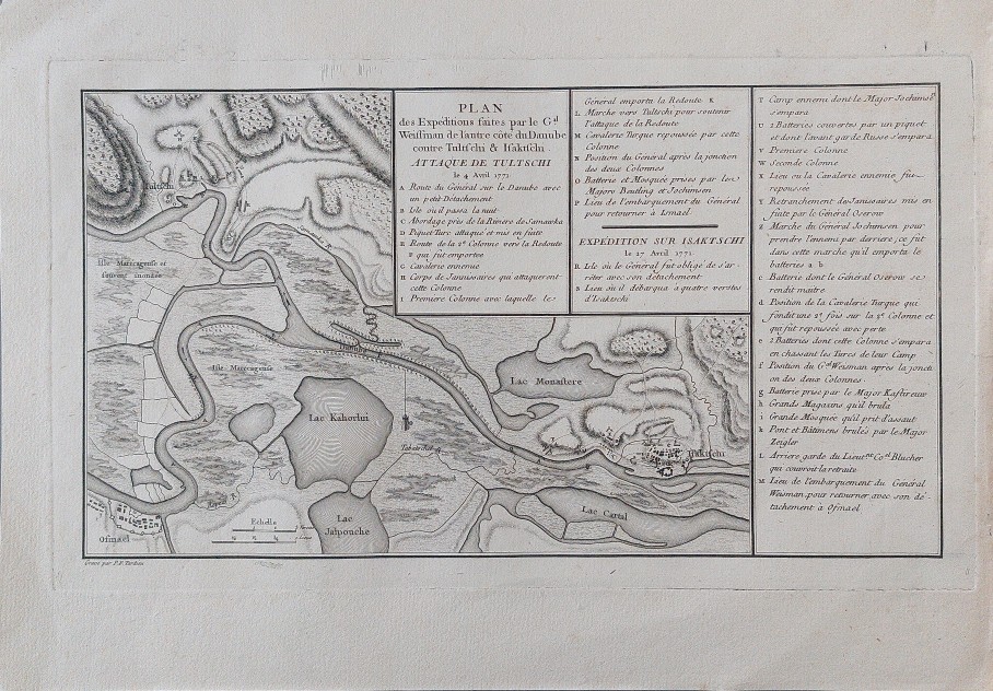
Plan des Expéditions faites par le Gal. Weissman de l’autre côté du Danube contre Tultschi & Isaktschi. Attaque de Tultschi le 4 Avril 1771. Expédition sur Isaktschi le 27 Avril 1771
Description
The map shows the expeditions of Russian German general Otto Weissman against Tulcea and Isaccea, now in Romania, from April 1771, detailed step by step. Can be identified on the map: Danube between Ismail (Ukraine), Tulcea and Isaccea (Romania), lakes Kuhurlui, Yalpuh, Kahul (Ukraine), Monastere (now lake Telincea, Romania showing possible the existence of an older monastery near Saon Monastery founded in 1846), rivers Somova (Romania), Tabatschel and Repedi (Ukraine). These expeditions are in the context of Russo-Turkish War (1768–1774) closed by the Treaty of Küçük Kaynarca, which for Moldavia had one immediate effect by loosing its northeast part, later known as Bukovina, to Habsburg Empire.
It was published in the “Histoire physique, morale, civile et politique de la Russie Ancienne” by N. G. Le Clerc, Paris 1783.
Date
1783 ( undated )
Dimension
Paper size approx.: 34 x 24 cm
Mapmaker:
Pierre François Tardieu (1711 - 1774)