The Cartography of the Danube River in two sets of maps by Nicolaes Visscher and Johann Baptist Homann
by Iulian Lucaci
The Danube River, Europe’s second-longest one, starting in the Black Forest Mountains in Germany and flowing into the Black Sea, has been a focal point of cartographic efforts for centuries. Among the many mapmakers who illustrated this vital waterway, Nicolaes Visscher I, followed by his son Nicolaes Visscher II and Johann Baptist Homann stand out as influential figures of the seventeenth and eighteenth centuries. Their maps of the Danube reflect not only their cartographic skills but also the historical and geopolitical context in which they lived and created these maps.
Both mapmakers created a set of maps that covered the entire course of the river, 2,850 kilometers. Each set has three maps depicting the upper region from its source to Vienna and Pressburg (Bratislava); the middle covering the region of eastern Austria to Serbia; and the lower in which the river moves from Belgrade to the Black Sea.
The striking similarities between these maps suggest a direct influence of Visscher’s work on Homann’s. It’s considered that Homann mastered engraving in Amsterdam when he might be the Visscher’ pupil. The first 2 maps from the sets are almost identical showing that Homann used the Visscher’s maps, but on the Danube lower part map he updated the content in the light of the latest Austria-Turkish War (1716-18) when he was the official cartographer of Habsburg emperor Carol VI. This pattern of Visscher’s influence is evident in Homann’s other work as well. For instance, his 1716 map of Ireland closely mirrors a 1689 map of Nicolaes Visscher II, with Homann explicitly crediting Visscher in the title cartouche.
Fig. 1 Johann Baptist Homann, Map of Ireland,1716, 22 x 18.5 in, © Geographicus Rare Antique Map.
This practice of building upon previous cartographic works was common among the mapmakers, allowing for the preservation of valuable geographical knowledge while integrating the latest updates and style preferences.
The Historical Context
Visscher publishing firm was a prominent Dutch map publisher for a century. The firm was established around 1620 in Amsterdam by Claes Jansz Visscher (1587 – 1652), considered one of the Jadocus Hondius’s pupils. Claes was followed by his son Nicolaes Visscher I (1618–79) and his grandson Nicolaes Visscher II (1649–1702), both receiving the privilege to publish maps from Belgii Federati, now The Netherlands. The firm continue to publish till 1726 when after the death of Nicolaes Visscher II’s widow, Elizabeth Verseyl Visscher was sold to Peter Schenk, another maps publisher. Visscher family produced on their own account an Atlas Contractus about 1660 and an Atlas Minor about 1677, which went in 15 editions, and include their set of maps of the Danube.
Johann Baptist Homann (1664-1724) was the most prolific map publisher of the 18th century. He was born in Bavaria, Germany and it’s considered that he mastered engraving in Amsterdam because when he moved to Nurnberg in 1691, he started to produce maps. Homann might be one of the Nicolaes Visscher II’s pupils. After a short stay to Viena between 1683 and 1685 he moves back to Nürnberg and establish his commercial publishing firm in 1702. The first edition of his Neuer Atlas was published in 1707, followed in 1716 by his masterpiece Grosser Atlas ueber die ganze Welt where was included also his set of maps of Danube. By 1715 he received the privilege to publish maps becoming imperial cartographer of Holy Roman Emperor Charles VI and member of Royal Academy of Sciences in Berlin. His son, Johann Christoph Homann (1703-30) continued to publish maps and had the wish to inherit the firm by his two head managers under the name “Homann Heirs”. In this way a family company survive to Homann family till 1848 and published many editions included new updates of their atlases. About Danube set of maps, as imperial cartographer of Holy Roman Emperor Charles VI, Homann had access to the most up-to-date cartographic information during the Austro-Turkish War (1716-18).
Visscher’s set was first published around 1677 in Amsterdam and Homann’s around 1716 in Nürnberg.
In the intervening four decades there were several events which would affect how the maps of those countries through which the river flowed were depicted.
The Great Turkish War (1683–99) took place between the Ottoman Empire and the Holy League, consisting of the Holy Roman Empire, Poland – Lithuania, Venice, later Russia. During this time took place also the Nine Years’ War (1688 -1697) between France and Grand Alliance, consisting of Dutch Republic, England and Habsburg Monarchy, later Spain and Savoy. The most important moments of The Great Turkish War were:
- The Battle of Vienna in 1683, when the Ottomans were defeated by the Holy Roman empire and Polish - Lithuanian Commonwealth, which became a turning point for Ottoman expansion into Europe
- The Siege of Buda in 1686, when the Holy League liberated Buda (modern Budapest), marking the beginning of the Ottoman retreat from Hungary
- The Second Battle of Mohacs in 1687 and the Battle of Zenta in 1697 when the ottomans were defeated
- The Conquest of Belgrade in 1688, when the Holy League briefly captured Belgrade, later retaken by the Ottomans in 1690
- The Treaty of Karlowitz in 1699, which marks the end of the Ottoman control in the region and established the Habsburg monarchy as the dominant power: Habsburgs receiving the big parts of current Hungary and Croatia and former Slavonia, Venice obtaining most of Dalmatia, the Ottomans retaining Belgrade and Banat.
Beside the big cities as Vienna, Buda and Belgrade on both maps are shown the small important villages of Mohacs, Zenta and Karlowitz.
The Austro-Turkish War (1716-18) saw further Habsburg victories against the Ottomans, solidifying their dominance over the Danube. The most important moments were:
- The Batle of Petrovaradin in 1716, when prince Eugen of Savoy won a major victory over the Ottomans
- The Recapture of Belgrade in 1717, when Habsburgs conquered Belgrade, a strategic fortress that was key to controlling the Danube
- The Treaty of Passarowitz in 1718, when the Ottomans ceded Belgrade, Banat, Oltenia (western part of Wallachia) and the north of Bosnia to the Habsburgs, further pushing them down the Danube.
Petrovaradin and Belgrade are presented on both maps, but Passarowitz is shown only on Homann’s map in the light of the recent treaty.
Differences between the maps
Leaving aside the title and the colors, which could reflect the preference of the map recipient, I want to highlight the main differences of the maps content, visible in a greater number on the representations of the lower part of the river. For this reason, let me start to present first the lower part of the Danube.
One main difference is about the meridians and parallels lines which are part of Visscher’s maps, while missing in the Homann’s map, helping with the orienteering on the maps and indeed helping me in doing this comparison. By checking the David Rumsey collection of maps, it seems that this characteristic was common for Homann’s detailed land maps perhaps in order to keep the map clearer and because are not so important for orienteering as on the sea maps.
The Maps of Lower Part of the Danube
The translation of Visscher’s map is “A very accurate map, showing both the lower part of the Danube River, from the city of Belgrade to its mouths, and the smaller rivers flowing into it – as well as adjacent regions, such as Transylvania, Wallachia, Moldavia, Bulgaria, Bessarabia and Rumelia, and other neighboring tracts of Ukraine and Podolia”. [1]
Fig. 2 Nicolaes Visscher, Map of Lower Part of Danube, 1677, 46 x 58 cm. ©Universitätsbibliothek Bern, https://doi.org/10.3931/e-rara-128351
The Homann’s title translates as “The lowest part of the Danube River (here shown from the city of Belgrade, flowing through the Black Sea to Constantinople) – in which Transylvania, Wallachia, Moldavia, Bulgaria, Serbia, Rumelia and Bessarabia, with neighboring regions, are shown”. [2]
Fig. 3 Johann Baptist Homann, Map of Lower Part of Danube, 1716, 46 x 57 cm ©Universitätsbibliothek Bern, https://doi.org/10.3931/e-rara-128379
From the titles of the two maps above it is worth mentioning a difference – the introduction of Serbia (‘Servia’) in the title of Homann’s map, which was included in the Habsburg monarchy after the Treaty of Passarowitz in 1718 as crownland but only till 1739 when was reconquered by Ottoman Empire.
In Homann’s depiction of Hungary are visible details like village Nerethas in sector (s,e), some parts of the notations like COM from Zaboliensis Comitatus, RIENSIS from Bihoriensis Comitatus in sectors (s,e) and (s,f) , SIS CO from Torantaliensis Comitatus, ENSIS COM from Orodiensis Comitatus, NADIENS COM from Chanadiens Comitatus in sectors (s,g) and (s,h), which indicates better information about Hungary and its counties in the light of the recent war, used as means to a sequel of the Homann’s map on the middle part of Danube, where these counties have the full name.
Another difference to be mentioned here consists of the two mistakes from Visscher’s map in its country names are corrected in Homann’s map: the name of PRINCIPATUS VALACHIAE PROPRIE is corrected into PRINCIPATUS MOLDAVIAE and the name of PRINCIPATUS MOLDAVIAE is corrected into PRINCIPATUS VALACHIAE.
On the Danube River one can observe multiple differences. On Homann’s map in the Banat region, called Temsuensi Comitat, are visible consolidated fortresses used during the Austro-Turkish War (1716-1718): Pancsowa, now Pančevo in Serbia, Vipalanka, now Banatska Palanka in Serbia, Almas in Romania. The Pančevo fortification was built during Turkish rule and was conquered in 1716 by Habsburg Imperial troops under command of Claude Florimond de Mercy who will become after the war the commander of the new Habsburg military province Banat of Temeswar. Vipalanka fortress doesn’t exist anymore as was a practice after a peace to destroy some threatening fortresses. Interesting is that Ram Fortress, now still preserved, from the opposite bank of the Danube is not mentioned.
Some villages and fortress mainly along Danube from Visscher’s map are not available on Homann’s map: Kemy, Orzona, Dombolanich, Haran, Buzdozin, Busczin, S. Lasla, Maraculla, Pescabara, Liberas, Petick, Erfomelo, Mesesemlo, maybe as effect of the Astro-Turkish war.
The big cities and fortresses like Belgrade, Semendria now Smederevo, Temeswar now Timisoara, Vidin and some fortresses and villages like Galombatz, Orsova, Meadia are on both maps. Belgrade and Semendria are shown on both maps as well fortified cities. Belgrade, conquered in 1717 by Prince Eugen de Savoy, after Treaty of Passarowitz in 1718, becomes part of the Habsburg monarchy when the fortress was largely rebuilt and modernized.
The western part of Wallachia, now the Oltenia region of Romania, which was included in the Habsburg monarchy after the Treaty of Pasarowitz as Banat of Krajowa (Craiova), it’s still captured on the Homann’s map bearing its former name as an Ottoman province, namely Sangiacatus Bydenensis as on Visscher’s map.
Further details and corrections can be spotted such as the towns Tergosyl, now Targu Jiu and Kraiova, now Craiova, all in Romania and fortress Severin or Sewrin, now Drobeta-Turnu Severin which on Visscher’s map is on the opposite site of the Danube to Vidin in fact being 100 km between them. On both maps are shown the ruins of the bridge built by roman emperor Nerva Traianus between 103 and 105 to defeat the Dacians.
What is missing on the Homann’s map of lower Danube is the town of Passarowitz, now Požarevac in Serbia where in 1718 was signed the peace treaty between Ottoman Empire and its adversaries Habsburg monarchy and Republic of Venice. This town is shown on Homann’s map of middle Danube.
The Danube in this region creates the impressive Iron Gates gorge thru the mountains. In 1972 and 1984 were 2 hydroelectric dams built on Danube and the resulted lakes changed the landscape and the position of the villages around Danube.
Fig 4 Nicolaes Visscher, Details about Banat and Oltenia.
Fig 5 Johann Baptist Homann, Details about Banat and Oltenia.
Homann’s map marks the Danube River crossing the Black Sea to Constantinople and then the Marmara Sea. It is highlighted in the title of the map. It is a symbolical representation of an existing trade route which at the time when the map was created, around 1720, was still controlled by the Ottoman Empire, nevertheless Austria was allowed free trade all over the Ottoman Empire and to use their own ships on the Danube only. The route has this comment on the map: “Fluviales aqua Danubi a fragnante Pontica colore et mosu notabiliter distonete”, “The river water of the Danube is noticeably different from the breaking color and movement of the Black Sea”.
Fig 6 Johann Baptist Homann, Details Danube – Constantinople Route
Another small difference I noticed is the name Kersoua, a new fortress visible on the Homann’s map near the starting point of the Danube Delta, possible location of the antique town of Noviodunum, now Isaccea, Romania.
As for the maps legends both have similar content, although looking more stylish on the Visscher’s map.
The Maps of Middle Part of the Danube
The full name of the Visscher’s map translates into “A very accurate map, showing both the middle part of the Danube River, from the city of Lintz to the city of Vienna and the smaller rivers flowing into it - as well as adjacent regions such as Hungary, Slavonia, Croatia, Bosnia, Dalmatia, Serbia, as well as the borders of Germany, Poland, and Greece”.[3]
Fig 7 Nicolaes Visscher, Map of Middle Part of Danube, 1677, 46 x 55 cm. ©Universitätsbibliothek Bern, https://doi.org/10.3931/e-rara-128338.
Moving to the Homann’s map the its full name is : “The middle part of the river Danube (delineated from the city of Lintz to and beyond the city of Vienna with the tributaries) - in which Hungary, Sclavonia, Bosnia, Dalmatia and Serbia with other neighboring regions are accurately described”.[4] Fig 8 Johann Baptist Homann, Map of Middle Part of Danube, 1716, 46 x 57 cm ©Universitätsbibliothek Bern, https://doi.org/10.3931/e-rara-128372.
Comparing the maps, the differences are insignificant. I can highlight the presence on the Homann’s map of the city of Passarowitz, now Požarevac in Serbia, where the Treaty of Passarowitz was signed in 1718. The city is nevertheless missing from the common region in Homann’s map on the lower Danube, although represented on his middle map of the Danube. It seems that political updates were not propagated in all the maps. Fig 9 Johann Baptist Homann, Details about Passsarowitz.
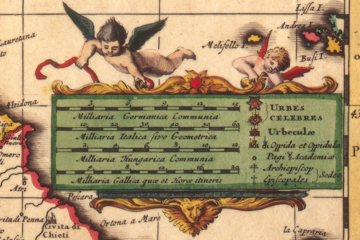
The map legends are similar in content, while on the Visscher’s map we can notice a drawing of 2 angels. Fig 10: Nicolaes Visscher, Details about legend.
The Maps of Upper Part of the Danube
The full name of the Visscher’s map translated is “A very accurate map, showing both the upper part of the Danube River, from its sources to the city of Bratislava, and the smaller rivers flowing into it - as well as adjacent regions, such as Austria, Styria, Carinthia, Carniola, Bavaria, Suebia, Switzerland, Tyrol, the greater part of Italy, as well as the borders of France and Hungary”.[5] Fig 11 Nicolaes Visscher, Map of Upper Part of Danube, 1677, 46 x 55 cm. ©Universitätsbibliothek Bern, https://doi.org/10.3931/e-rara-128390.
The full translated name of the Homann’ map is: translating into: “The upper part of the Danube River (designated from its sources near Donesching to the city of Bratislava) - in which Suebia, Bavaria, Austria, Styria, Carinthia, Carniola, Tyrol, Switzerland and a large part of Italy are shown”.[6] Fig 12 Johann Baptist Homann, Map of Lower Part of Danube, 1716, 46 x 54 cm ©Universitätsbibliothek Bern, https://doi.org/10.3931/e-rara-128325.
Except the style of Visscher, who shows again two angels around the map legend these 2 maps are identical.
Fig 13 Nicoles Visscher, Angels from legend
Conclusions
Based on existing differences I can remark the Homann’s interest in presenting the new political changes and the new information gathered on Belgrade, Banat, Oltenia because of the Austro-Turkish War from 1716-1718 and the preference of Visscher for a stylish presentation of the maps’ legend.
-
Visscher, “Exactissima tabula, qua tam Danubii fluvii pars inferior, a Belgrado urbe usq ad ejus ostia, et minores in eum influentes fluvii, quam regiones adjacantes, ut Transylvania, Valachia, Moldavia, Bulgaria, Bessarabia et Romonia, aliiq Ucraniae ac Podoliae tractus finitimi ostenduntur”. ↑
-
Homann, “Danubii fluminis (hic ab urbe Belgrado, per Mare Nigrum usq[ue] Constantinopolim defluentis exhibiti) pars infima - in qua Transylvania, Walachia, Moldavia, Bulgaria, Servia, Romania et Bessarabia, cum vicinis regionibus ostenduntur”. ↑
-
Visscher, “Exactissima tabula, qua tam Danubii fluvii pars media, ab urbe Lentiæ ad Bydenam urbem, et minores in eum influentes fluvii - quam regiones adjacentes ut Hungaria, Slavonia, Croatia, Bosnia, Dalmatia, Servia, nec non Germaniæ, Poloniæ, et Græciæ confinia ostenduntur”. ↑
-
Homann, “Danubii fluminis (ab urbe Lentia usq[ue] et ultra Bydenam urbem cum influentibus fluviis delineati) pars media - in qua Hungaria, Sclavonia, Bosnia, Dalmatia et Servia cum vicinis aliis regionibus accuratè describuntur”. ↑
-
Visscher, “Exactissima tabula, qua tam Danubii fluvii pars superior, ab ejus fontibus ad Posonium urbem et minores in eum influentes fluvii - quam regiones adjacentes, ut Austria, Stiria, Carinthia, Carniola, Bavaria, Suevia, Helvetia, Tirolis maxima pars Italiæ, nec non Galliæ et Hungariæ confinia ostenduntur”. ↑
-
Homann, “Danubii fluminis (à fontibus prope Doneschingam usq[ue] Posonium urbem designati) pars superior - in qua Suevia, Bavaria, Austria, Stiria, Carinthia, Carniola, Tyrolis, Helvetia cum magna parte Italiæ exhibentur”. ↑